
The South River is in the Upper Ocmulgee basin and feeds Georgia’s mightiest river, the Altamaha. This massive drainage system flows to the Atlantic Ocean on Georgia’s coast.
The South River Watershed
The South River is one of only two urban-origin rivers in the state of Georgia. Its watershed comprises approximately 544 square miles of creeks and streams that drain large sections of Fulton, DeKalb, Clayton, Henry, Rockdale, Newton, and Butts Counties. The river is a headwater of Georgia’s largest freshwater system, the Ocmulgee and Altamaha River basins, which feed the Atlantic Ocean.
The South River’s main headwater streams were piped many decades ago. Now, the river daylights at Norman Berry Drive, just north of Atlanta’s Hartsfield-Jackson Airport, in the city of East Point (Fulton County). From East Point, the river flows across south Atlanta on its 60 mile journey southeast to Jackson Lake (reservoir) where it joins the Alcovy and the Yellow to form the Ocmulgee River.
The Ocmulgee River flows to Macon, Georgia where it meets the Oconee and becomes the Altamaha River – Georgia’s largest river. The Altamaha drains into the Atlantic Ocean on the Georgia coast near Darien and Little Saint Simons Island.
The South River flows southeastwardly for 60 miles from East Point to Jackson Lake where it meets the Alcovy and Yellow to become the Ocmulgee River. The South River watershed drains ~544 square miles of land from parts of seven different counties – Fulton, DeKalb, Clayton, Henry, Rockdale, Newton, and Butts Counties.
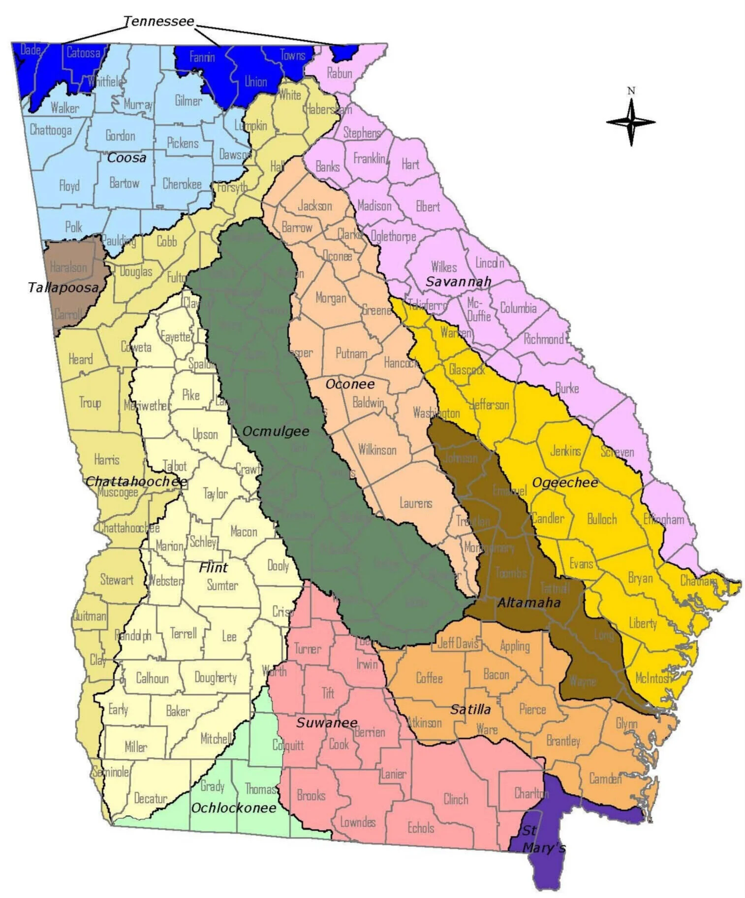
GEORGIA’S 14 RIVER BASINS
The South River is located in the Upper Ocmulgee basin (green). It is a headwater of the Ocmulgee River which feeds the Altamaha, Georgia’s largest river, and drains to the Atlantic Ocean on Georgia’s coast.
Photo credits: map c/o Georgia Department of Community Affairs; mantle image by @virginiedk
NEED TO GET YOUR BEARINGS?
Support collective, community advocacy and progress.